
Introduction
In this article we explore the earliest records of the houses of Killiney and Ballybrack. We also examine the roads network which was a very simple affair in the early part of the 19th century. Maps prior to 1837, when the Ordnance Survey first mapped the district, were not of a sufficient scale to provide much detail in terms of the general housing stock. However, they do give an indication of the larger estates and the main roads serving the area. The list compiled for this piece includes all of the named houses which existed in 1837. Earliest known occupants have also been listed. Along with the first OS map of 1837 we are also fortunate to have the information provided in Lewis’s Topographical Dictionary for the adjoining parishes of Kill and Killiney. This document lists the main estates and residents of the parishes and is a useful reference to compare with the information provided on the map. Another directory which proved useful was Watson’s Almanac of 1834 for Dublin City and County. Where available we have included references to houses which appeared in the historical newspaper archives which can be searched online.
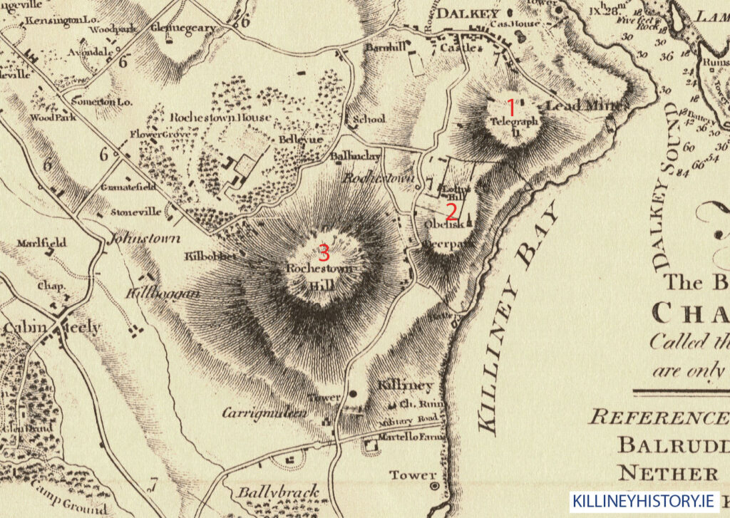
Our interactive map below makes it easy to identify the houses and monuments, give it a try.
Earliest houses identified
Rocque’s map of 1760 shows buildings in locations which correspond to the following properties:
- Rochestown House
- Beechwood House.
- Bellevue Park.
- Mount Mapas (Killiney Castle). Captain Mansel is named as owner
Killiney Road leading down from Killiney Castle is identified as ‘New Road’. The only other significant road at this stage is Killiney Hill Road, Military Road has not yet made an appearance.
Taylor and Skinner’s road map of the district which was surveyed in 1777 and corrected in 1783 identifies a handful of properties and their owners. These include:
- Mount Druid, Mr. Wilson
- Loftus Hill, Medlicott Esq
- Ballinclea, Judge Lill
- Rochestown, Malpas Esq
The 1787 map of the Malpas Estate by John Sherrard is one of the earliest sources to depict some of the larger houses in greater detail which includes landscaping layouts and building footprints. Unfortunately not many of the houses are named but tenants names are given and we have been able to identify the properties by comparing to current mapping. The map only covers the Rochestown Estate which extended to the coast to include Rocheshill, Killiney Village and Killiney Hill. The houses identified here match those in Rocque’s map:
- Rochestown House. John Malpas landlord of the entire estate
- Beechwood House. Occupant is Patrick Darcey esq.
- Bellevue Park. Occupant is Mrs. Lill and Lessee is T.T. Medly Esq
- Mount Mapas (Killiney Castle)
- A number of cabins and smaller buildings can be made out around Killiney Village
The Ballinclea Estate of Mrs. Lill is outlined but no detail is provided on the buildings or field layouts in this plot. The road from Bray to Dublin is identified and is shown to follow the present day route via Killiney Hill Road, turning onto Killiney Road at Killiney Castle. Ballinclea Road leading down to Rochestown Avenue is also indicated. Ballinclea Road follows a different route to today’s layout and appears to pass Bellevue Park (now Cluny School) on the northern boundary, not the southern side as it does today.
In 1816 Taylor’s map shows all of the houses listed above along with ‘Ballinclay’ and ‘Carrigmuleen’. This would appear to be the site of the current Carrickmoleen possibly replacing the earlier house. Killiney Castle is now called Loftus Hill and the surrounding estate of Killiney Hill is identified as Deerpark. A school is shown where Urney, now Gleneagles, on Killiney Road is located.
Military Road appears for the first time, this is shortly after the construction of the Martello towers and military installations in 1804/1805. Martello Farm is shown on Military Road and marks the location of what was later to be called Martello House. This was subsequently incorporated into the grounds of Ashurst. A Lime kiln can be seen at the bottom of Military Road just above Killiney Strand. This would have provided much needed lime which was used in the construction of the batteries and Martello towers.
With the advent of the Ordnance Survey everything changes with regards to mapping and the accurate representation of information available in the public realm. The professional surveyors who produced the first 6 inch maps of Ireland applied a strict set of criteria to their work resulting in the ground breaking maps which were produced in the late 1830’s. Killiney and Ballybrack along with the rest of the country were surveyed in detail to a very high level of accuracy. It is possible to overlay these maps with current digital mapping and the quality of the historical document really shines through.
It is these early manuscript maps known as the ‘fair plans’ which we have used as the baseline for the listing of the houses in the district. The Killiney ‘fair plans’ were made in 1837 and represent the first true representation of what existed on the ground at this time. Remember, this was long before the coming of the railway which radically changed the situation and made the area a most desirable place to live for those wealthy individuals who worked in the city but wanted to escape to the resort like surroundings of Killiney in their down time. This ‘snapshot’ of Killiney before the boom recorded many houses and buildings which have long since vanished or have been changed beyond recognition. Many of the houses listed below no longer exist and are indicated with an *. Quite a few have been replaced by houses built later in the 19th or 20th century. A considerable number have been changed beyond recognition but it is still possible to discern some of the very old features if examined closely.
32 of the houses in the table below are mapped for the first time although they may have appeared in street directories like Watson’s of 1834. The road layout is largely the same as before with the exception of the opening up of Church Road linking Rochestown Avenue to Ballybrack Village. Interestingly Church Road ends at a T junction in the village where it meets Military Road. Shanganagh Road has not been built at this stage but appeared in the later 1843 published version of the map. Essentially the development of Killiney took the form of ‘ribbon’ development along Killiney Hill Road as can be clearly seen from the map below. It was not until much later that the coastal roads were developed along with the connecting roads from the main thoroughfare above eg. Strathmore Road, Kilmore Avenue and Marino Avenue linking to the new Railway Road above the beach.
Whereas the Taylor map of 1816 is dominated by the military installations in the district it is clear that houses are now being built along Killiney Hill Road between Killiney Village and Military Road. The new names which are printed on the map, commencing from the village going south, are: Killiney House, Killiney Park, Saintberry, Templeville, Druid Lodge, Desmond (now Padua), Percy Lodge, Rose Lodge, Marino (now Abbey Lea), Dorset Lodge and Rosetta.
Ballybrack Village is denoted by one sole building and is at a very early stage of it’s development. A number of houses have appeared further along Church Road towards the church. The main houses of the area are Ballybrack Grove (now demolished), Wyattville (now demolished) and Ballybrack Lodge (now Ballinacor House).
Listing of the earliest houses in Killiney & Ballybrack, as existing in 1837
Houses denoted in the table below with * no longer exist. Where highlighted you can click through to the relevant article which provides further detail. We hope to have articles on all the houses in due course so do come back. Any information on the houses would be greatly appreciated.
| Name of house | Alternative name | Earliest record | Earliest known Occupant |
|---|---|---|---|
| Anglesea* | 1833 NAI record | Frederick Saintbury Parker, 1833 | |
| Abberley* | Farm Lodge | 1837 Map | |
| Ballinclea* | 1590 list of outlaws | 1590 Rowland Goodman | |
| Ballybrack Grove* | Shanganagh Grove | 1837 Map | Japhet Alley, 1837 |
| Ballybrack Lodge | Egremont, Ballinacor House | 1837 Map | George F. Fowler, Thom’s 1847 |
| Beechwood* | 1760 Map | 1787 Patrick Darcey esq. | |
| Bellevue Park | 1760 Map | 1787 T.T. Medly Esq | |
| Carrigmuleen | Carrickmoleen | 1816 Taylor’s map | |
| Coolmeen | Urney, Eagle Lodge | 1834 Watson’s Almanac | Joseph Farrell, smith and farrier, 1834 |
| Dalkey & Killiney Dispensary | Bellair House | 1837 map | Frederick Hasler MD |
| Desmond | Padua | 1832 NAI record | Frederick Saintbury Parker 1832 |
| Dorset Lodge | Saint Declan’s | 1834 Watson’s Almanac | Thomas Crofton, 1834 |
| Druid Cottage* | Glen Druid | 1837 Map | Mrs. Patten, Lewis 1837 |
| Druid Lodge | Mount Druid? | 1777 Taylor & Skinner Map | Peter Wilson |
| Edenville | Eden Villa | 1837 Map | Mrs. Rose Byrne, Thom’s 1847 |
| Evergreen Lodge | Marchington, Cedar Lodge | Edward Walpole, Thom’s 1858 | |
| Ivy Lodge | Ivy Cottage 1837 | 1834 Watson’s Almanac | James Dowling, 1834 |
| Killiney Castle | Mount Malpas, Roxborough, Loftus Hill, Killiney Castle | 1740 Built by John Malpas as a speculative development. | Captain Edward Maunsell, 1755 |
| Killiney Church | St. Matthias’ | Built in 1835 | Rev. Charles Sleater, Thom’s 1847 |
| Killiney Cottage | Banqueting Cottage, St. Mary’s | 1837 Map | Mr. McCann, 1847 |
| Killiney House | 1834 Watson’s Almanac | Captain B. Gaynor & James Rhody | |
| Killiney Lodge* | Merton Lodge | 1834 Watson’s Almanac | Mrs. Elizabeth Clements Southwell & David Tobin Esq |
| Killiney Park* | Park House | 1802 advert | Mrs. Elizabeth King, 1834 |
| Kilmarnock | Haldane Grange | 1832 advert | Lt. John Robert Baker, 1834 |
| Laughlinstown House | Loughlinstown House | c.1660 Built by Sir William Domvile replacing existing medieval castle | Sir William Domvile |
| Marino | Abbey Lea | 1836 to let advert | Mrs. King, Lewis 1837 |
| Martello Cottage | Kilmuire/Little Anstice | 1837 Map | William Milling Esq, Thom’s 1847 |
| Martello Farm* | Martello House/Ashurst site | 1816 Taylor’s map | Thomas Oxley, 1834 |
| Mount Mapas | Mount Mapas Cottage | 1836 to let advert | Robert Warren |
| Mountain View* | Mr. Farrell’s Yard and Forge | 1837 Map | Mr. Michael Farrell, Thom’s 1847 |
| Obelisk Cottage* | St. Germains (demolished) | 1837 Map | Martin Creane, Thom’s 1847 |
| Percy Lodge | 1837 Map | Thomas Farrell, Thom’s 1847 | |
| Plasnewyd* | Rock Lodge | 1837 Map | The Hon. Mrs. Kaye |
| Rainford | Rainsford Lodge | 1837 Map | Mr. Thomas Murphy, Thom’s 1847 |
| Rochestown House* | c.1750 Built by John Malpas replacing existing medieval Rochestown Castle | John Malpas | |
| Rose Cottage | Rose Lodge (1837) | 1834 Watson’s Almanac | James Farrell, 1834 |
| Rosetta | Site of Rathleigh | 1837 Map | Hugh Ferguson, Thom’s 1856 |
| St. Helena | Uplands | 1837 Map | Fagan, The Misses, Thom’s 1847 |
| Saintbury | St. Bury | 1832 newspaper advert | Frederick St. Bury Parker Esq |
| School | Hillview, St.Abbey’s | 1837 Map | |
| Templeville | c.1827 ‘Killiney Surroundings’ by Figgis | Rev. Charles Sleater, 1827 | |
| Victoria Lodge | The Cottage | 1837 Map | Mrs. Byrne, Thom’s 1847 |
| Woodbine Cottage | 1837 Map | Miss Mullin, Thom’s 1847 | |
| Wilmont | 1837 Map | Captain Swainson, Thom’s 1847 | |
| Wyattville* | 1837 Map | Mr. James Reilly, Thom’s 1847 |
Interactive Map of Killiney & Ballybrack in 1837
We have traced and overlayed the houses and buildings of note from the 1837 ‘fair plan’ map onto the current map of the district. Hover over the red blocks to get the name of the property. If available you can click through to the article on that house or monument. The roads as existed in 1837 are also highlighted and the development along these spines is visible.