
Introduction
The importance of Killiney Bay in the defence of Ireland against the Napoleonic threat is something which has left a lasting mark on the Irish coastline. Although their function quickly became redundant, the structures which were put in place over a very short period of time, have in the most part survived to this day. They are now so embedded in the landscape that it is hard to imagine not having their presence in our midst. In this article by Pól Ó Duibhir he explores the background to the siting of these military emplacements and brings our attention to parts of the infrastructure which are no longer with us. Thanks again Pól!
The Martello Towers of Killiney Bay by Pól Ó Duibhir
One of the things I always have to remember when doing any sort of history research, be it family or local, is context. It is seldom right to judge historical figures by today’s values and standards. I have to look at decisions in the context they were taken and knowing the options that were open at the time.
There is another nuance to context though, and this is not taking objects in isolation. This is particularly true of both the Martello towers and the Georgian buildings. I remember learning that the value of a Georgian house is not just the house in isolation but the vista of which it is part. That is why it is so awful when a whole Georgian street is punctured with ill-fitting buildings.
A Network
The same is true of the Martello towers. They were conceived as an interdependent network and the loss of one affects the whole network. Sadly, many of the emplacements, between towers and batteries, in Killiney Bay are no longer with us. But there is enough there to recreate the network in our minds with a bit of imagination.
The Killiney Martellos did not just come out of the blue. There was a gradual lead up to their construction as an appreciation of how the Bay might best be defended against a French maritime invasion evolved. Make no mistake, this was a real threat at the time.
An Interim Solution
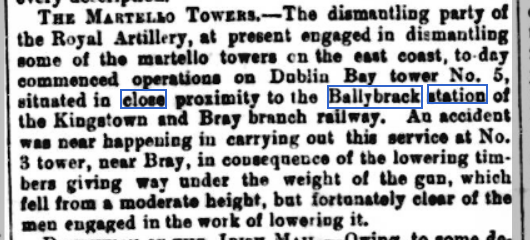
Formal planning started in the mid 1790s with the establishment of a vast military camp in Loughlinstown. For a few years this was the only defence of the Bay. Lord Carhampton, Commander of the Crown Forces in Ireland, instructed Major le Comte de La Chaussée to prepare a coastal defence plan for Killiney bay. The Major presented his incisive plan, outlining the works required in the short term, in February 1797. The report was accompanied by a coloured map of the bay, supporting his analysis. La Chaussée, probably a fugitive from the French Revolution, had joined the British forces as a defence engineer and cartographer. His instructions were in English and the report itself was in elegant French. The report left open the possibility of the subsequent construction of more permanent defences against a French attack.
The French had already attempted to land forces in Ireland, and it was not long before the British authorities embarked on an ambitious programme of permanent defences. These consisted of fortifications, mounted with 18 and 24 pounder cannon, and they stretched from Bray to Balbriggan. The works which were commenced in 1804 were completed the following year, under the direction of Colonel Benjamin Fisher.
La Chaussée’s vision
Look at the illustration of the Bay below, think about it, and then put the cursor over the pic and see how La Chaussée saw it. First the lay of the land. The yellow area is the 200ft contour and above. Its effect is to oblige any enemy force, that succeeds in landing and wants to take the capital, to swing to the right along the King’s Highway (today’s N11). But the object is to stop the ships and prevent anyone landing in the first place and to do this the various gun emplacements have to be strategically placed. La Chaussée identified three major areas of vulnerability – that is where there were gaps in the cliffs – two to the north of the Bay (Killiney beach and the estuary of the Shanganagh river) and one to the south (today’s Bray promenade). And remember that, at that point in time, the British could also call on the troops from the Loughlinstown camp.
[iheu_ultimate_oxi id=”3″]
Execution of the plan
This illustration shows how La Chaussée envisaged his six placements in the Bay. Three primary positions: one covering the north of the bay, another the south, and one in between, albeit on top of the cliffs, to preserve continuity/overlapping fire right the length of the Bay. The additional three pink markers are “enfilade”, primarily designed to rake the beaches should the enemy land. La Chaussée’s defences were conceived as a stop gap until more substantial defences could be put in place and this happened much later, in 1804. A network of nine Martello towers (7 martellos and two stand-alone batteries) were built. If you hover the cursor over the picture (and back) you will see that six of the towers were in positions identified by La Chaussée and an extra three were added to strengthen the defences at the most vulnerable points and to ensure continuity right across Dublin, and not just Killiney, Bay.
[iheu_ultimate_oxi id=”4″]
The Details
So, let’s look at each of these emplacements in turn.
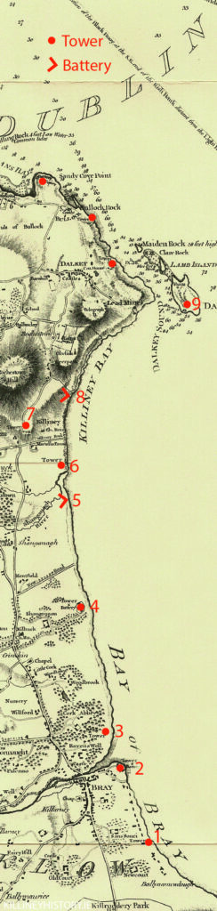
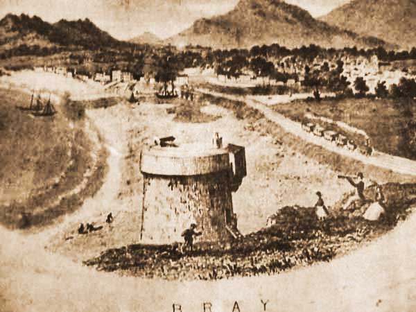
Tower No.1
This Martello was located at the southern end of what is now the Bray promenade. Niall O’Donoghue, who restored the Killiney Hill Road tower, purchased the photo off the internet for a princely sum.
That turned out to be a nicked copy from the National Library’s Lawrence Collection and the original is of far better quality. The pic above is a detail from the NLI original. The pic could be easily missed as it is not in the main collection but in the “stereo pairs”, for anyone who remembers the Viewmaster 3D viewers of the last century.
The absence of the cannon on the top dates it post 1866. The tower was demolished in 1884 and no trace of it remains.
Tower No.2
At the harbour in Bray. The tower is still there. A military man who owned it at one stage put the extra sun storey on it and when Bono lived there he darkened the glass.
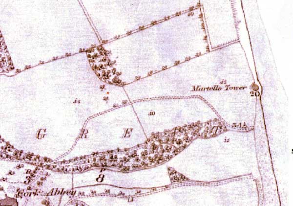
Tower No.3
The Tower at Cork Abbey no longer exists. It was either demolished or fell into the sea. This drawing gives a good idea of its function which was essentially to protect the Dargle estuary.
Tower No.4
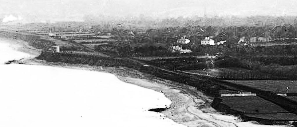
This Tower was on the cliffs at Maghera point and is clearly seen in this Lawrence print from the late 19th century. You can also see the walls enclosing Battery number 5 in the foreground. The tower no longer exists having fallen victim to coastal erosion. This is the Tower which provided continuity of fire between the north and south parts of the Bay. It had two batteries, one on each side but they look to have gone by the time this photo was taken.
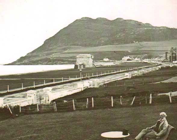
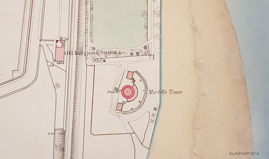
Battery No.5
[iheu_ultimate_oxi id=”6″]
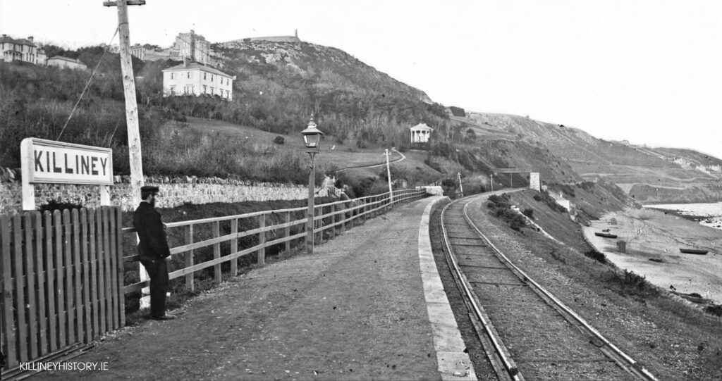
This was one of two stand-alone batteries in the Bay. It didn’t last long and was taken out of commission as early as 1812. If you place your cursor over the picture you will see a to scale ground plan of the battery as it was in its early days. Note that the cliffs in the plan extend well beyond their actual position in modern times. The path to the left of the battery is that of the old railway line to Bray. This also had a problem with cliff erosion and the railway was diverted inland in 1914 at Killiney.
Tower No.6
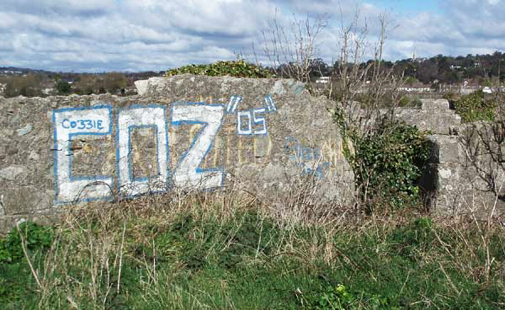
This Tower, at the bottom of Strand Road, was designed to protect the Shanganagh river estuary where there is a break in the cliffs. It was bought and “restored” in the 1970s by Victor Enoch who capped it with two further storeys. Pure vandalism.
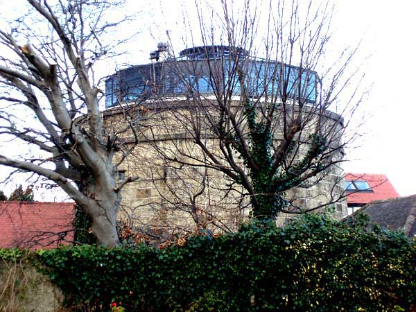
Tower No.7
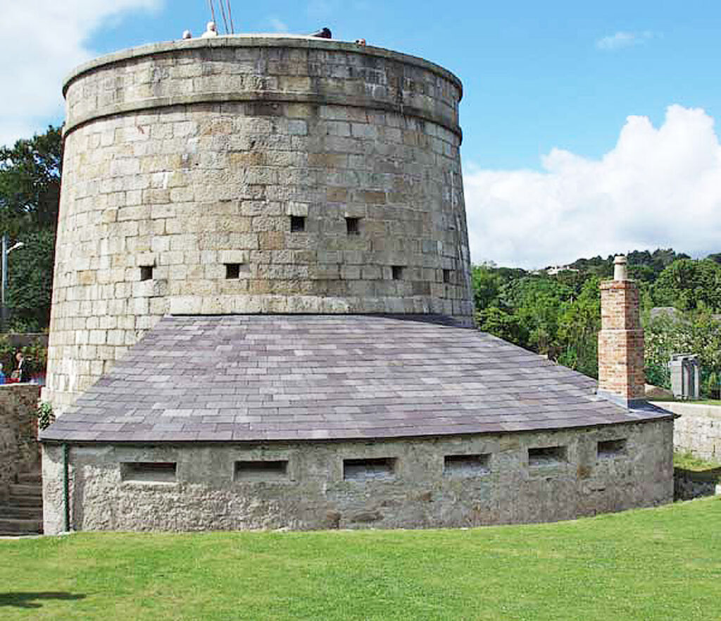
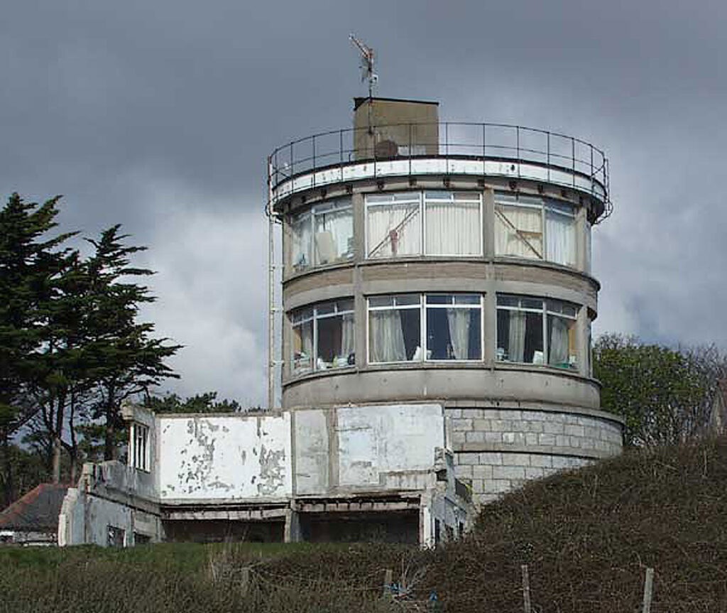
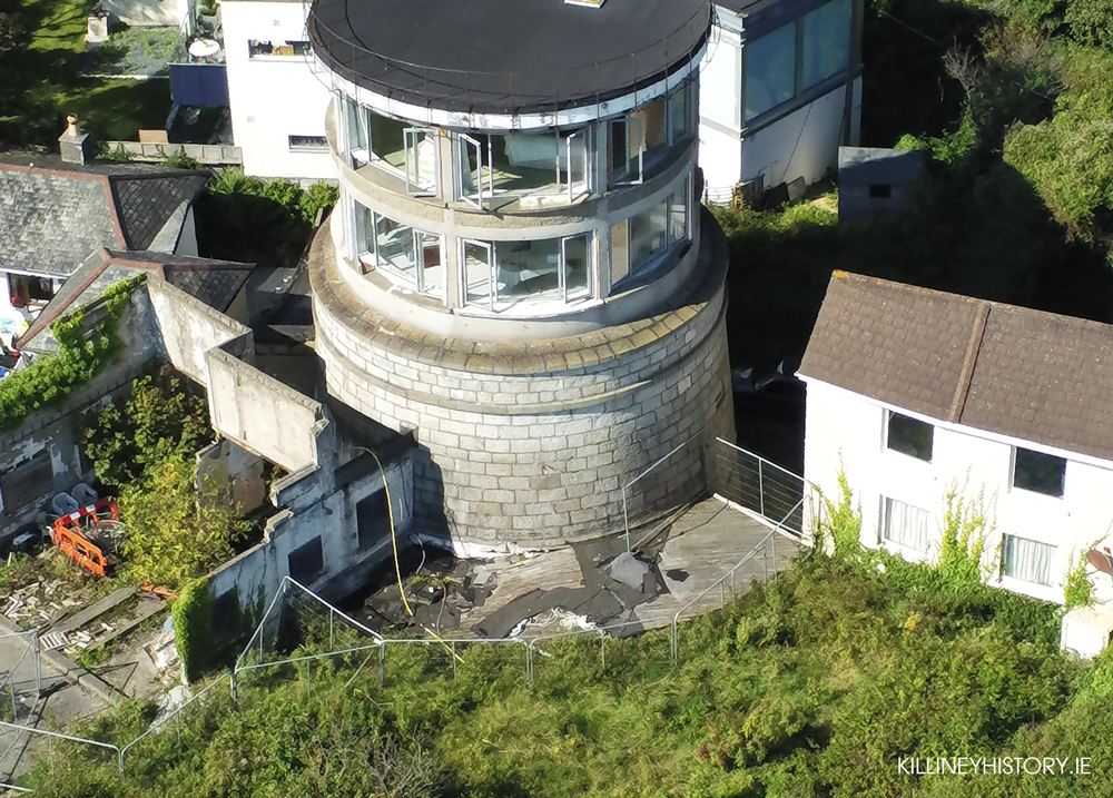
This is the Tower on Killiney Hill Road magnificently restored by Niall O’Donoghue in the early naughties. It got a favourable mention from the jury in the Europa Nostra competition in 2014, and rightly so. It is unusual in being inland and on a height. When constructed it had sight of all the other emplacements and was a sort of command tower. Because of its height it also had command of the King’s Highway. It has hosted a number of Bloomsdays and a wedding and has at times been open to visitors. Its future is uncertain since Niall died in May 2022. You can read a detailed description of Niall’s restoration of the tower here.
Battery No.8
[iheu_ultimate_oxi id=”5″]
This battery was situated at the northmost point of Station Road. It was on the site of one of the earliest Killiney railway stations and had to be demolished as the railway came through. Placing the cursor over the pic will show the extent of the battery.
No.9 Tower
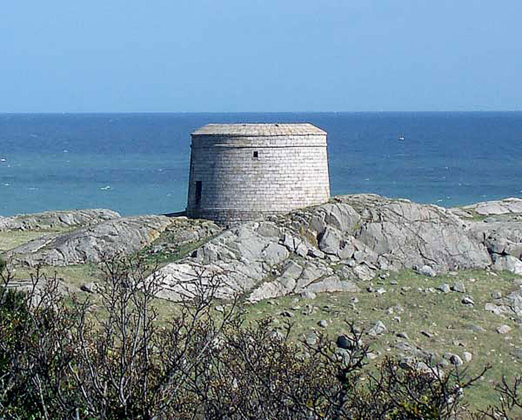
This magnificent specimen on Dalkey Island completes the ring of defensive positions in Killiney Bay.
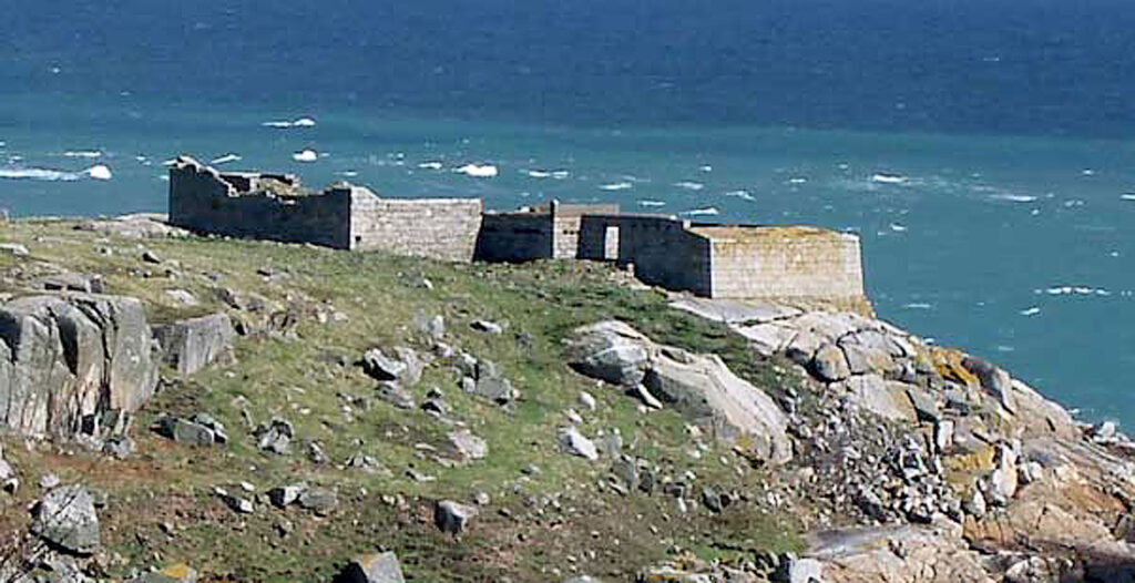
It was accompanied by a battery which must be one of the best preserved in Dublin Bay, and possibly elsewhere in the country.
The isolated location may explain the good condition of both these buildings.
Current inventory
Of the nine emplacements in Killiney Bay:
Gone: Four emplacements, Nos. 1, 3, 4, and 8
Restored: No.7
Residence: Nos. 2 and 6
Ruin: No.5
Awaiting restoration: No.9